INFORMATION ANALYTICAL SYSTEM GEODVA.CLOUD
Description
GEODVA.CLOUD is a unique geo-information system for marketing analysis that will allow you to:
- do a market analysis using a large amount of data (from 100,000 units) in a few seconds;
- visualize results of the analysis and present them in an illustrative form;
- simplify the process of making management decisions and improve their efficiency and reliability;
- predict the impact of factors and customer reactions more accurately.
Functions and features
GEODVA.CLOUD has the following features:
- data input and automatic verification of their correctness;
- storage, simple processing and illustrative visualization of large amounts of data (from 100,000 units);
- analysis, modelling and forecasting tools;
- simple data converting from a customer base to the values used in analysis, modeling and forecasting;
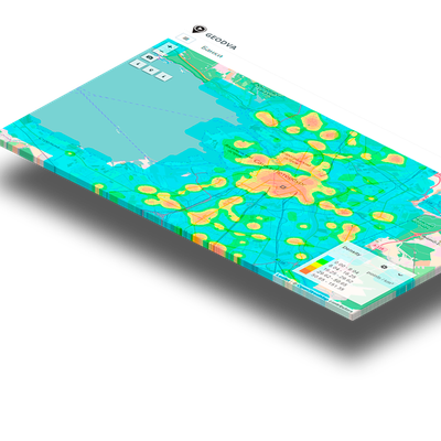
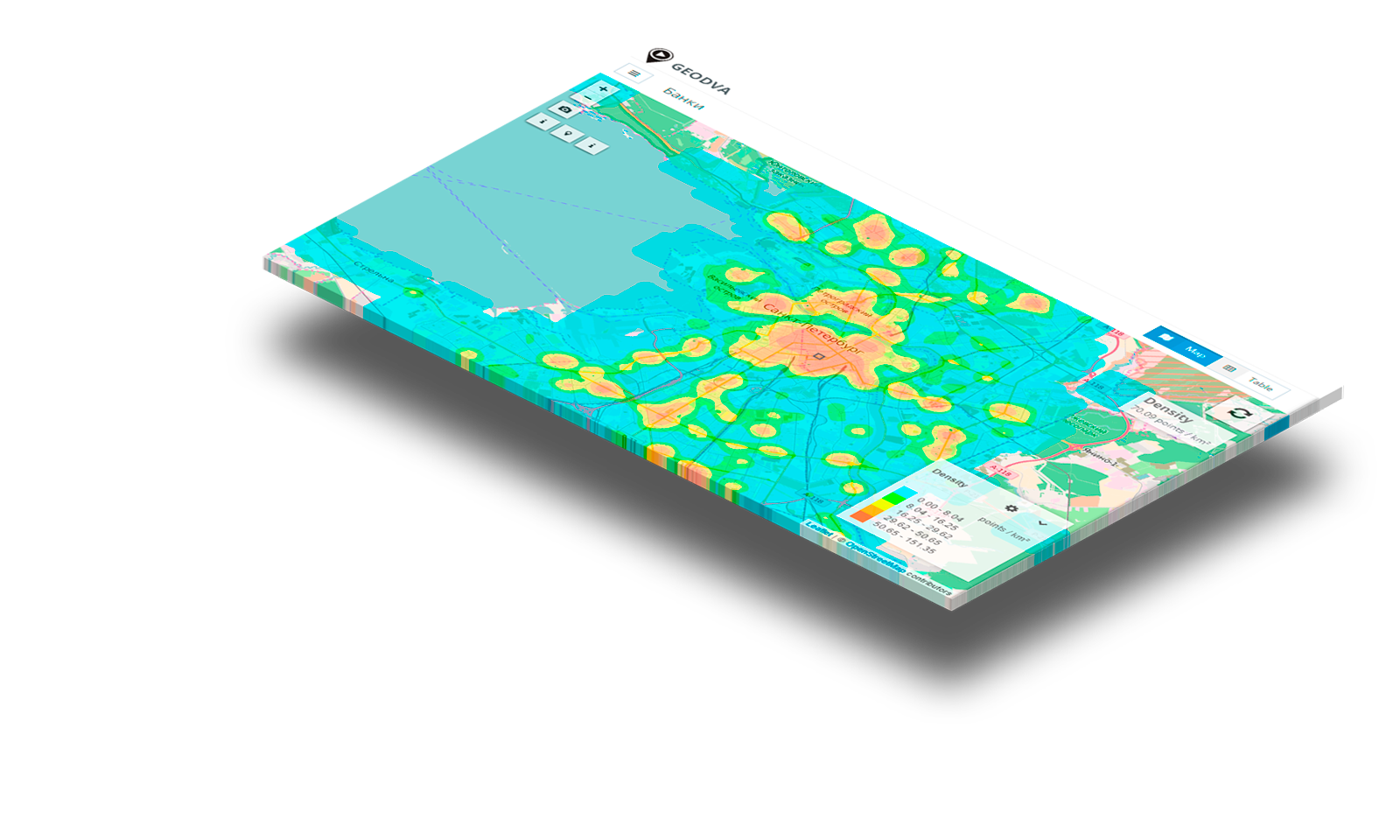
- dynamic and static data visualization on a geographic map with easy scaling and customizable detailing;
- convenient formation of presentation and illustration materials.
Application areas
1. Companies which, as part of their activities, enter into direct contracts with clients or have an access to the list of their addresses with the number of the residence home mentioned.
2. Companies which do not have customer addresses, but plan to expand their business in new territories or spread deeper in the developed territories.
3. Dynamic companies operating in highly competitive markets. To develop their business, they have to constantly monitor the business environment, improve efficiency and use of the customer base. GEODVA.CLOUD is ideal for companies with a large customer base spread geographically:
- retail chains;
- chains of cafes and restaurants;
- wholesale companies: federal, national and regional dealers and distributors;
- banks and financial institutions;
- auto services and car dealers;
- insurance companies;
- paid medical services;
- pharmacy networks;
- real estate agencies and developers;
- digital, cable and satellite TV providers;
- personal services agencies providing services at clients’ homes;
- courier and logistics companies;
- companies specializing in online trading.
Tasks
The main task of GEODVA.CLOUD is the effective management of territories of any scale, from an urban neighbourhood, district to a geographic region or several countries. Using GEODVA.CLOUD you can:
- make the best plan for the development of the territory;
- analyze the coverage of the territory and continue the development properly;
- provide operating management of the territory, e.g. opening, closing and optimizing of retail outlets;
- test new ideas and methods for the acquisition, development, and management of territories;
- replicate and adapt successful business practices to other territories to suit their characteristics.
Technologies
postgresql + postgis, OpenSteetMap, mongodb, redis, nginx, django, django-rosetta, Nominatim, docker, imposm, webpack, bootstrap 3, leaflet, OpenStreetMap, knockout.
Project benchmarks
- Unit-test coverage: 90%
- Duration: 296 days
- Complexity: 5 out of 10